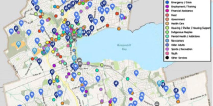
Barrie council can see your social-service organization pretty clearly now.
At council’s request, municipal staff recently built a city-wide map that lists the location of more than 20 types of social services — from financial assistance and shelter programs, to Indigenous centres and health-care facilities.
This map contains more than 850 data points, mostly collected from County of Simcoe and 211 Ontario resources. Barrie’s Geographic Information System (GIS) branch also developed an online, interactive element.

“The web map allows users to identify and find social services within a specified distance of an address, location or point on the map by the applying buffer distances; (it) highlights information about the organization such as the services it provides, address, phone number and website,” GIS manager Brent Harlow said.
Locations of sensitive services, like women’s shelters, are not included.
However, this map should help council members make informed planning decisions, Coun. Mike McCann said.
“We are going to be a drastically-changed city,” he said. “We’ve got a lot of different services coming to council that would like to be a part of Barrie. More information is prudent. This has got to be a strong foundation for a guiding document; any time we have social services coming into our downtown, we’re very quickly able to see where all the social services are to make sure they’re not clustered together.”
To view the map, visit .
